Will Rogers World Airport (OKC)
Orientation and Maps
(Oklahoma City, Oklahoma (OK), USA)
Founded in 1889, Oklahoma City has grown rapidly over the years and is now home to many striking modern buildings, futuristic skywalks, a scenic canal and a large and popular baseball park. Now the capital of Oklahoma, the city continues to reinvent itself and strives to improve its appearance, with a relatively new convention center and an impressive selection of riverside walking trails.
In the southwestern region of Oklahoma City, Will Rogers World Airport (OKC) is connected by Blue Vans Shuttle buses and Yellow Cab taxis. Greyhound buses also serve the city and operate from the Union Bus Station on West Sheridan Avenue, linking Oklahoma City with many major US cities, such as Dallas, Kansas City and Tulsa. Further buses at the terminal are run by Jefferson Lines, while city buses are managed by MetroTransit.
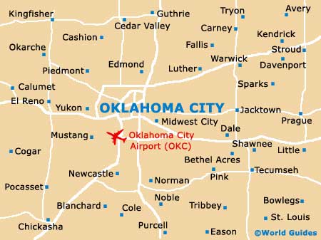
Will Rogers World Airport (OKC) Maps: Important City Districts
Several major interstates pass through Oklahoma City and include the I-35, the I-40 and the I-44, together with Route 66. The city's lively downtown district is edged on its southern side by the I-40 interstate, with 5th Street being located directly north. Shartel Avenue borders the western side of downtown Oklahoma City, and the Santa Fe train line is located just a short distance to the east, close to the acclaimed Bricktown district.
One of Oklahoma City's most famous neighborhoods, Bricktown is dominated by many historic red-brick buildings and structures, most of which date back to the historic railroad days. The area's canal has breathed new life into this district and transformed the whole area. Many visitors to Oklahoma City enjoy taking a trip in one of the numerous water taxis, which are readily available along the canal. The Bricktown district is also home to a plethora of eateries, including many topnotch restaurants overlooking the mile-long canal.
USA Map

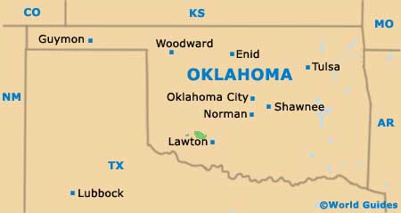
Oklahoma Map
Oklahoma City Map